Comptche to the Town of Mendocino, Kind of…

At the Intersection, Turn Left or Right
The word “verdant” keeps ricocheting through my mind as we descend these lush, rolling hills with a view for miles. I can’t remember what it means and we have no cell service so Siri can’t save me this time. I’ve heard it on NPR dozens of times, an ad for a charitable foundation: “A more just, verdant, and peaceful world.”
There’s a tiny town, a post office, a single gas pump, and a small store with a hand scrawled message as you enter, reading, “Don’t Dilly Dally at the Door,” where I can stop for a few minutes of cell connection on the way back to camp. But I’ll have to wait until we’ve finished this stretch on foot first.
Spoiler: verdant means green with grass or other rich vegetation.
My friend Jo and I are on day three of one of our walking jags. Over the last few years, we’ve been slowly making our way along the 840-mile coast of California, venturing out for four or five days whenever we can manage to work it into our respective schedules.
Roughly Ninety-nine percent of the time, if there’s a notable elevation change over the course of a walk, we opt for the uphill route. But, today, after a long, steep drive, caravaning to drop of one of our cars, we decide to take the easy way out and go with gravity. We’re giddy with the indulgence of what feels like a ten-mile escalator ride down overlapping spring green hills with criss-crossing creeks and rivers beside which we take barely-needed breaks and set out little mini picnics of crudités seasoned with coarse salt and mint leaves, tortilla-sized leaves of romaine into which we stuff goat cheese, marinated white beans and homemade pickled daikon radish.
We scored a perfect campground, a Hipcamp on a massive, open meadow, that we have all to ourselves for four nights. Apparently, no one else was in the market for hanging their soaking wet clothes to dry inside their tents and sleeping in their cars instead or standing in three inches of water on the marshy meadow floor while reheating last night’s spaghetti. The camp is part of a working farm located on the precise byway we need to cover. We spend the first day walking back to the beginning of this road, then doubling back to cover its full length. On day two, chipper and eager for a walk in the rain, we reach the corner of Flynn Creek and Comptche Ukiah Road where we can turn left toward Mendocino or right toward Ukiah.
A sign at this juncture makes the decision easy. It indicates that Mendocino is one mile to the left. I start walking to the right but Jo asks, “Why aren’t we going that way? Toward Mendocino?” I move to take a look at the map application on my phone only to realize that we have no cell services. Instead, I explain to Jo that I did double check the maps last night and I know that while we do ultimately want to get to Mendocino, we are way more than one mile inland from the part of Mendocino we need to reach. I charted our course to take us inland this trip because this stretch of the coastal highway is not pedestrian friendly for long-distance walkers.
So right it is! Toward Ukiah, the largest city in Mendocino County with its population of 15,500. Neither of us know the area well and we’ll be without cell service for most of the day but the road just goes on and on so we keep following it all day and return the next day to do the same, covering a total of twenty-three miles.
We begin to grow curious as to just how long this road is and suspicious that we haven’t started veering back toward the coast yet. At the end of the day, we decide to drive to the end of the road. We end up in Ukiah, where, being back in cell range, we scour our phone maps and realize that we’ve gone far afield. I drive us back to the town of Comptche so we can retrieve Jo’s truck. While we’re there, I take another look at the sign that prompted me in the wrong direction. On closer inspection, I see that there’s a missing a digit. What reads as “Mendocino, 1 mile” should read, “Mendocino, 16 miles” We should have gone left back on day two!
We are reminded of a conversation we had on the first day of this walk when Jo told me that a friend of hers who is considering doing some adventuring asked her what questions she would pose to a potential traveling partner. Jo’s response came easily, “I would ask them what kind of person they become when they’re lost?” I am struck by the brilliance of both the question and Jo’s response and as we continue our walk, we talk about who we become when we’re lost.
This isn’t our first time getting off track, but it is by far the longest. Twenty-three miles off course. On foot! I take solace in the fact that it has been a wonderful, adventurous few days and that we’ve seen lots of things we would not have seen if we’d gone, the “right” way.” But I’m also feeling a little sheepish since I’m personally responsible for the mess up. Jo had suggested we go left right from the jump.
Jo’s response to my feeling bad about leading us astray is to suggest that we each take turns naming the things we would not have seen if we’d turned left. That’s who she is when she’s lost.
A gentle volley of conversation about all the benefits of my lost bearings begins. Jo takes the first serve, describing the tiny, fragile pink orchids that we found dotting the forest floor and I return, recalling the man we crossed paths with who was out foraging black trumpet mushrooms and showed us his haul, proudly noting that a day’s hunting will cover a good share of his weekly expenses. We recount our delectable picnic on the bank of Big River and the surprise of discovering Orr Hot Springs, a resort we’d both heard of many times over the years but had no idea where it was located.
I mention the little hilltop neighborhood where a resident allowed us to take up one of the parking spots along their private road, where it was otherwise impossible to park because there is barely a shoulder. For a bit, we rally back and forth, naming signs we’d seen along the way, “hubcap ranch” Jo says and I come back with, “BINGO tonight at 7 p.m. in Community Hall.” She adds, “eggs for sale” I respond, “Apples for sale.”
In tandem, we piece together the day’s adventure of meeting a property owner along the road and taking an extensive walking tour of his many acres of rugged land. The man is roughly half redneck and half hippie, with a name to prove the latter, and has three orange cats: Just Mo, Other Orange Cat, and Bob. We listened to his orange cat adventure stories involving a boat, a Coast Guard helicopter rescue and a waterproof sack, and a story about his feisty lesbian neighbor, who he describes as short in stature, but long on personality, threatening him that if he messes with her spring water access (which falls squarely within the boundaries of his property) one more time, she’d,“string him up by the balls in the Comptche post office.” Ultimately, an unlikely friendship emerged and the neighbor has become one of his most beloved friends.
Arriving back at our base camp, we get to work reorganizing our gear and prepping for dinner. At first light, we’ll break down camp and head back home. But for now, we revel in being two small figures in a great open green space surrounded by gumdrop shaped hills, sitting in camp chairs with warm bowls of good food in our hands. In the distance we hear lowing cows and the occasional bark of a herding dog. Otherwise, just peace in this small town, this sweet patch of rural California.

I remember hearing references to being “out on the open road” in songs and conversations as a child, and grasping the wistful longing of it without quite knowing what it meant. Now just imagining a wide, empty, treelined country road could slow the exhale of a blood pressure cuff wrapped around my bicep.

The single gas pump in Comptche. Jo and I both used it and experienced the muscle memory of handling the old-timer.

I can’t overstate the delight I find in discovering flowers I’ve never seen before. These are delicate, wild, forest flowers called Calypso orchids that we spotted throughout our walks in Comptche and surrounds.

Our kitchenette at a Comptche Hipcamp. We were the only guests and had acres of open farmland surrounded by lush green hills all around us.

The road into OtterValleyFarm Campground
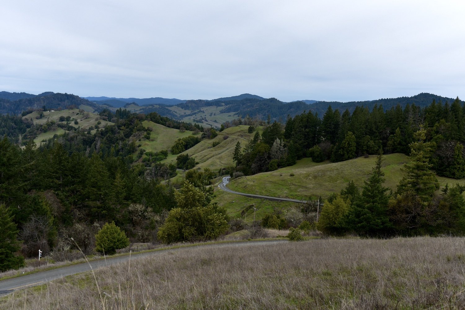
The beginning of an amazing, mostly downhill walk on Comptche-Ukiah Road. We almost always opt for the uphill way, but it was so fun to take a walk that was basically a down-escalator ride
